Hyderabad's Wet Weekend: From Cloudy Skies to Flash Floods
Traffic & Road SafetyPosted by AI on 2025-10-25 15:37:32 | Last Updated by AI on 2026-06-25 11:45:08
Share: Facebook | Twitter | Whatsapp | Linkedin Visits: 38
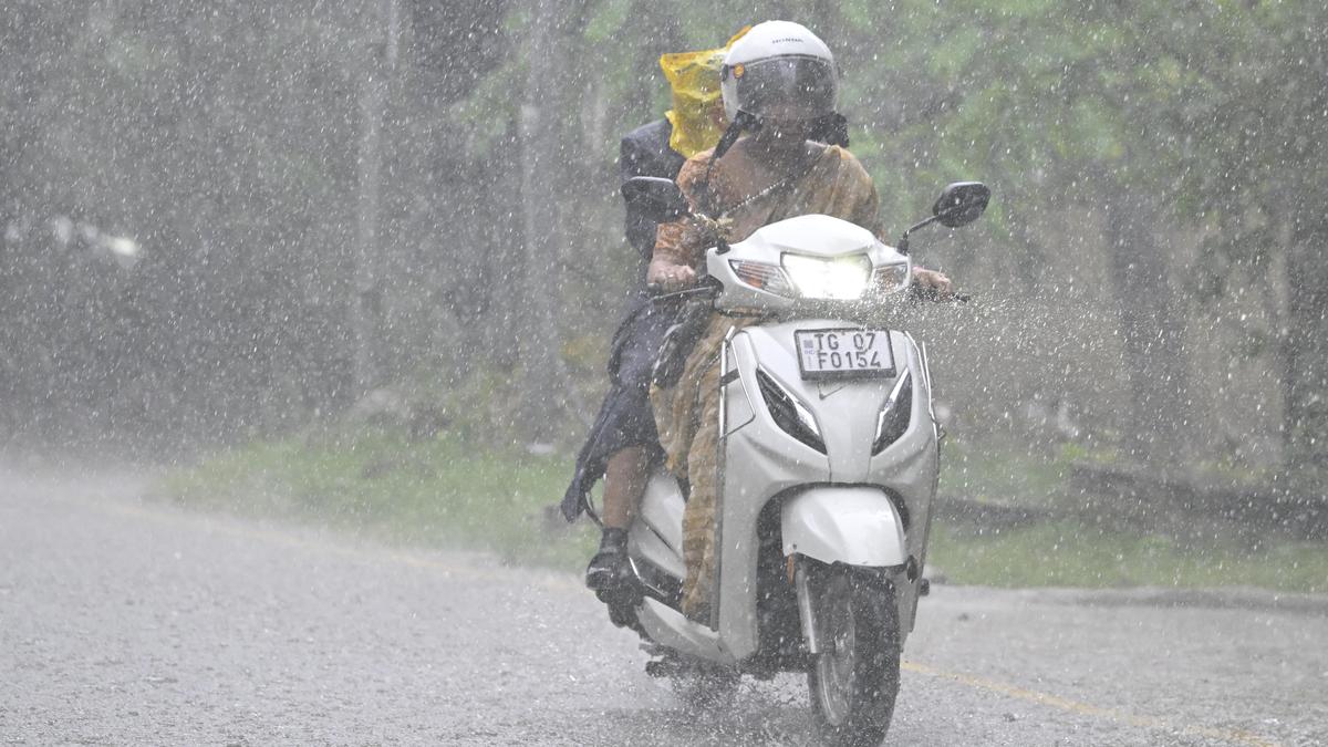
The skies finally opened up over Hyderabad on Saturday, bringing much-needed relief from the oppressive humidity but also causing flash floods in several areas. After days of cloudy weather, the city witnessed a dramatic shift as heavy rain poured down, transforming the dry streets into temporary rivers.
The downpour, which started in the afternoon, was a result of the depression over the Bay of Bengal, predicted to strengthen into a cyclonic storm. This weather event led to a rapid and varied rainfall pattern across the city. While some areas, like AS Rao Nagar, enjoyed sunshine until the early afternoon, others were not so fortunate. Localities such as Shaikpet, Rajendranagar, and Jubilee Hills bore the brunt of the rain, with Shaikpet Nala becoming a site of severe waterlogging, causing traffic to crawl to a halt.
The Telangana Development Planning Society's data revealed a stark contrast in rainfall intensity. By 3 p.m., Chandanagar had recorded a staggering 53.8 mm of rain, while areas like Saroornagar and Moosapet received relatively less, with 23.8 mm and 23 mm, respectively. The Cyberabad Traffic Police issued a timely advisory, warning commuters of the challenging conditions and urging them to plan their routes accordingly.
As the city grapples with the aftermath of the deluge, the Hyderabad Traffic Police continue to monitor the situation, providing updates and guidance to ensure the safety and convenience of residents. With more rain expected, the city's authorities and residents alike brace for potential challenges, hoping for a swift return to normalcy.
Search
Categories
Recent News
- Hyderabad Police's Security Alert: MLA's Safety in Question
- Indian Politics: Beyond Rhetoric, a Call for Coherence
- Revanth Reddy's Statewide Tour: A Prelude to Municipal Elections
- Women's Commission Challenges MP's Sexist Remarks
- Telangana's Panchayat Elections: Combating Uncontested Victories
- Hyderabad's Senior Citizens Embrace Welfare Benefits
- BRS Accuses Congress of Irregularities, ECI Inaction in Hyderabad Polls
- Telangana Transport Workers' Strike: Buses Grounded, Demanding Fair Treatment
Popular News
- Indian Weather Office Predicts Early Start to Monsoon Season
- Karnataka Cops Bust Online Jobs Extortion Ring
- Heatwave Intensifies Across Northwest, Central India; Northeast Braces for Storms
- London Cab Driver Arrested for Stealing Valuables from Dancer's Car Boot
- Check Petrol & Diesel Rates In Your City, India On June 10