INS Sarvekshak Completes Major Hydrographic Survey in Mauritius
Current Affairs NationalPosted by NewAdmin on 2025-01-26 09:05:39 |
Share: Facebook | Twitter | Whatsapp | Linkedin Visits: 53
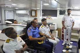
The Indian Navy’s INS Sarvekshak has successfully concluded a significant hydrographic survey in Mauritius, covering over 25,000 square nautical miles. The results of this survey were formally handed over on January 23, 2025. During the ceremony, High Commissioner of India to Mauritius, Anurag Srivastava, presented the fair sheet and nautical charts to President Dharambeer Gokhool. This achievement signifies a pivotal milestone in the maritime cooperation between India and Mauritius.
Significance of the Hydrographic Survey
The hydrographic survey plays a critical role in enhancing Mauritius’ maritime infrastructure. The newly developed nautical charts will aid in efficient resource management and coastal development planning. This initiative not only strengthens the robust partnership between India and Mauritius but also aligns with India’s SAGAR (Security and Growth for All in the Region) initiative, aimed at fostering regional security and growth.
INS Sarvekshak’s Advanced Capabilities
INS Sarvekshak, equipped with state-of-the-art hydrographic survey tools, such as sonar systems and specialized survey boats, plays a vital role in such missions. The ship also features a helicopter and a Bofors 40 mm gun, highlighting its operational versatility in maritime surveys and security.
Bilateral Defence Cooperation
India and Mauritius share a strong bond in defence collaboration. Mauritius actively contributes to India’s Information Fusion Centre through an International Liaison Officer and operates radar centres as part of a joint coastal surveillance system. This partnership is instrumental in bolstering regional maritime security.
Capacity-Building Initiatives in the Indian Ocean
India has ramped up capacity-building initiatives across the Indian Ocean, enhancing the capabilities of littoral states. The Indian Navy’s joint survey operations have covered an extensive 89,000 square kilometres over the past five years, producing 96 nautical charts. These efforts underscore India’s commitment to regional cooperation and sustainable maritime development.
Future Prospects for Collaboration
This successful hydrographic survey lays the foundation for expanded joint initiatives in maritime security and resource management. With Mauritius’ strategic position in the Indian Ocean, the collaboration is poised to grow, focusing on sustainable development and shared prosperity. The partnership between the two nations continues to be a cornerstone of regional stability and progress.
Search
Categories
Recent News
- Hyderabad Police's Security Alert: MLA's Safety in Question
- Indian Politics: Beyond Rhetoric, a Call for Coherence
- Revanth Reddy's Statewide Tour: A Prelude to Municipal Elections
- Women's Commission Challenges MP's Sexist Remarks
- Telangana's Panchayat Elections: Combating Uncontested Victories
- Hyderabad's Senior Citizens Embrace Welfare Benefits
- BRS Accuses Congress of Irregularities, ECI Inaction in Hyderabad Polls
- Telangana Transport Workers' Strike: Buses Grounded, Demanding Fair Treatment
Popular News
- Indian Weather Office Predicts Early Start to Monsoon Season
- Karnataka Cops Bust Online Jobs Extortion Ring
- Heatwave Intensifies Across Northwest, Central India; Northeast Braces for Storms
- London Cab Driver Arrested for Stealing Valuables from Dancer's Car Boot
- Navigating IPO Market Dynamics Amid Volatility and Regulatory Changes