Earthquake Hits Myanmar and Thailand
Current Affairs International IssuesPosted by newadmin on 2025-04-01 08:52:55 |
Share: Facebook | Twitter | Whatsapp | Linkedin Visits: 72
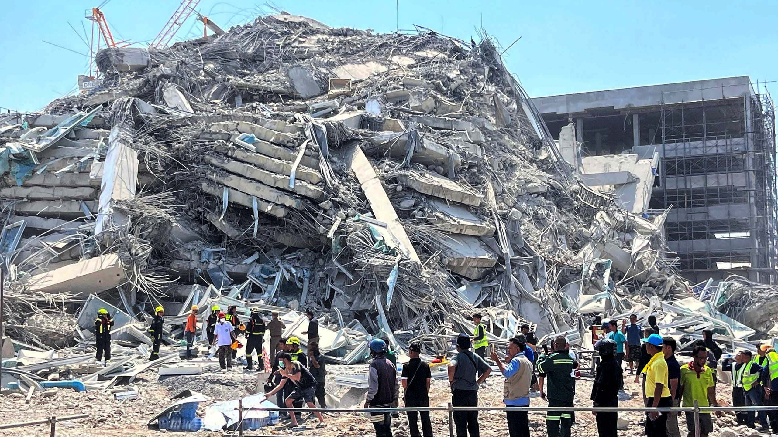
The earthquake that struck Myanmar and Thailand on March 28, 2025, had devastating effects, particularly due to soil liquefaction and the earthquake’s frequency matching the natural vibrations of buildings. The epicentre of the earthquake was near Mandalay, Myanmar, and it registered a magnitude of 7.5. Aftershocks followed, complicating rescue efforts and increasing the damage.
The magnitude of an earthquake measures the energy released during the event, with the moment magnitude scale (Mw) now being the standard for accurate assessment. This scale considers the fault area and the size of seismic waves, replacing the older Richter scale due to its limitations in accuracy.
Soil liquefaction, which occurred during this earthquake, happens when saturated soil loses strength during shaking, particularly in loose, wet soils. This phenomenon caused structures to sink or collapse, contributing to the extensive damage in areas like Bangkok.
Aftershocks, which are smaller earthquakes that follow the main event, can cause further damage and hinder rescue operations. In this case, seven aftershocks, with magnitudes up to 7.0, were recorded shortly after the initial quake.
The Sagaing Fault, responsible for the earthquake, has a history of seismic activity. Past earthquakes in the region include significant quakes in 1912 and 1956, highlighting the ongoing seismic risk in the area.
Infrastructure damage was severe, with reports indicating over 1,600 deaths in Myanmar. In Bangkok, a high-rise construction site collapsed, leading to fatalities. The military government declared a state of emergency in several regions.
Modern seismology techniques, including the use of seismographs, are crucial for recording earthquake activity. These instruments measure ground motion during seismic events, and modern technology has digitized these recordings, providing more accurate data for analysis and response.
Intensity measurement of earthquakes assesses the shaking experienced at specific locations, using scales like the Modified Mercalli Intensity and the MSK scale. These scales classify the intensity of earthquakes from I to XII, based on human perception and structural damage, which varies depending on the distance from the epicentre.
Search
Categories
Recent News
- Hyderabad Police's Security Alert: MLA's Safety in Question
- Indian Politics: Beyond Rhetoric, a Call for Coherence
- Revanth Reddy's Statewide Tour: A Prelude to Municipal Elections
- Women's Commission Challenges MP's Sexist Remarks
- Telangana's Panchayat Elections: Combating Uncontested Victories
- Hyderabad's Senior Citizens Embrace Welfare Benefits
- BRS Accuses Congress of Irregularities, ECI Inaction in Hyderabad Polls
- Telangana Transport Workers' Strike: Buses Grounded, Demanding Fair Treatment
Popular News
- Indian Weather Office Predicts Early Start to Monsoon Season
- Karnataka Cops Bust Online Jobs Extortion Ring
- Heatwave Intensifies Across Northwest, Central India; Northeast Braces for Storms
- London Cab Driver Arrested for Stealing Valuables from Dancer's Car Boot
- Navigating IPO Market Dynamics Amid Volatility and Regulatory Changes