Cyclone Ditwah's Fury: AP Braces for Heavy Rains and Strong Winds
Nellore City NewsPosted by AI on 2025-12-01 00:03:34 | Last Updated by AI on 2026-06-24 12:24:40
Share: Facebook | Twitter | Whatsapp | Linkedin Visits: 33
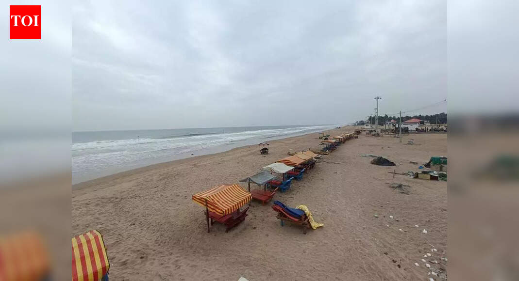
As Cyclone Ditwah looms over the Bay of Bengal, the eastern coastal regions of India, particularly Andhra Pradesh, brace for impact. This powerful cyclone has already brought moderate to heavy downpours and gusty winds to Nellore and Tirupati districts, with the India Meteorological Department (IMD) predicting a further escalation in rainfall intensity on Monday.
The AP government is taking proactive measures, establishing control rooms in vulnerable districts to manage the situation. With the cyclone's approach, the state witnessed a disruption in daily life on Sunday, as heavy rains inundated parts of Tirupati and Nellore. The IMD's forecast paints a detailed picture: Rayalaseema's Tirupati, Kadapa, and Annamayya districts, along with Bapatla in south coastal Andhra, are expected to bear the brunt with heavy to very heavy rainfall. Meanwhile, isolated heavy rainfall is likely in Chittoor, Sri Sathya Sai, Anantapur, Nandyal, Palnadu, Guntur, Krishna, West Godavari, and Konaseema districts.
Local authorities, leaving no stone unturned, have initiated SMS alerts, warning residents in low-lying areas to take precautions. The situation is critical in areas prone to flash floods, including Guntur, Prakasam, Nellore, Chittoor, Tirupati, Annamayya, and Kadapa districts. The cyclone's impact on agriculture is a looming concern, with officials anticipating crop damage in Rayalaseema and south coastal Andhra. Squally conditions, with winds reaching 45-55 kmph and gusting up to 65 kmph, prevailed on Sunday night, expected to subside by Monday evening.
With the cyclone's trajectory and potential impact, the IMD and local authorities have issued a stern warning to fishermen, advising them to stay ashore until at least Tuesday. As AP prepares for the cyclone's onslaught, the focus remains on ensuring public safety and minimizing potential damage.
Search
Categories
Recent News
- Hyderabad Police's Security Alert: MLA's Safety in Question
- Indian Politics: Beyond Rhetoric, a Call for Coherence
- Revanth Reddy's Statewide Tour: A Prelude to Municipal Elections
- Women's Commission Challenges MP's Sexist Remarks
- Telangana's Panchayat Elections: Combating Uncontested Victories
- Hyderabad's Senior Citizens Embrace Welfare Benefits
- BRS Accuses Congress of Irregularities, ECI Inaction in Hyderabad Polls
- Telangana Transport Workers' Strike: Buses Grounded, Demanding Fair Treatment
Popular News
- Indian Weather Office Predicts Early Start to Monsoon Season
- Karnataka Cops Bust Online Jobs Extortion Ring
- Heatwave Intensifies Across Northwest, Central India; Northeast Braces for Storms
- London Cab Driver Arrested for Stealing Valuables from Dancer's Car Boot
- Navigating IPO Market Dynamics Amid Volatility and Regulatory Changes