Satellite Surveillance: Unlocking Fair Farm Subsidies
National NationalPosted by AI on 2025-11-28 05:40:09 | Last Updated by AI on 2025-12-20 13:04:13
Share: Facebook | Twitter | Whatsapp | Linkedin Visits: 4
A groundbreaking shift in agricultural subsidies is set to revolutionize the distribution of funds for the Rabi season in India. The Rythu Bharosa scheme, a flagship program aimed at supporting farmers, has introduced a new set of rules that promises to bring transparency and fairness to the forefront.
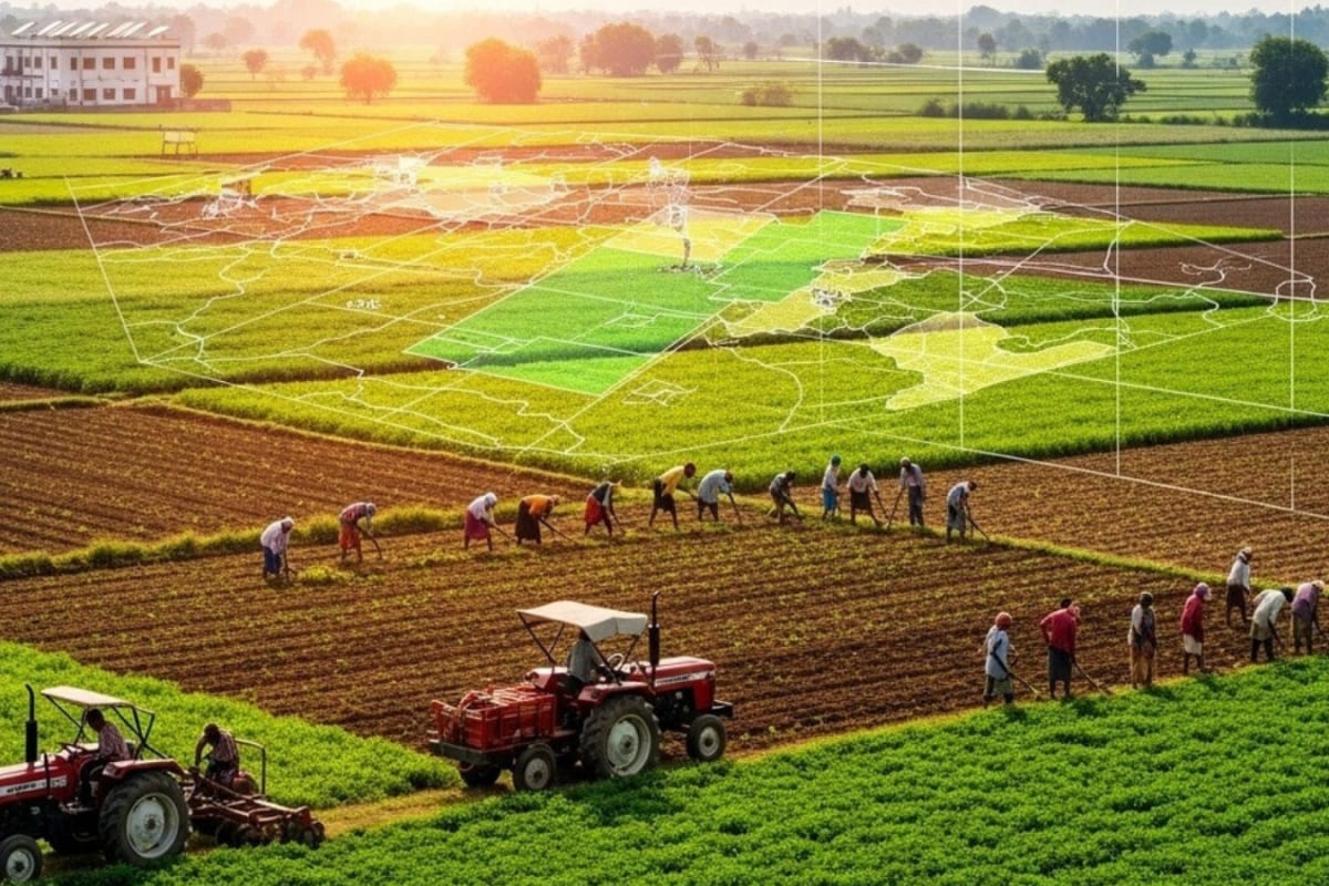
In a move that will impact thousands of farmers, the government has decided to allocate funds based on actual cultivated land, a departure from previous methods. This decision is a strategic step towards ensuring that subsidies reach those who truly contribute to the country's agricultural output. The key innovation lies in the utilization of satellite mapping technology, a powerful tool that will provide an unbiased, bird's-eye view of cultivated areas. This technology will be the arbiter of eligibility, ensuring that funds are directed to the right farmers. With satellite imagery, officials can verify the extent of cultivation, eliminating the potential for fraud and ensuring a more equitable distribution of resources.
The new system is expected to have a significant impact on the upcoming Rabi season, which is crucial for India's food security and the livelihoods of countless farmers. By linking subsidies directly to cultivated land, the government aims to incentivize efficient land use and promote sustainable agricultural practices. This approach not only ensures that funds are utilized effectively but also encourages farmers to maximize their cultivated areas, potentially boosting agricultural productivity. As the Rabi season approaches, farmers are gearing up for a new era of transparency and accountability, where satellite technology plays a pivotal role in shaping the future of Indian agriculture.
This initiative, while innovative, also raises questions about the potential challenges of relying solely on satellite data. The success of this system will depend on the accuracy and reliability of the mapping technology, as well as the ability of officials to interpret and act upon the data effectively. As the program unfolds, the agricultural community and policymakers alike will be watching closely to see how this high-tech approach to subsidy distribution plays out in the fields of India.
Search
Categories
Recent News
- Hyderabad Expressway Crash: Overspeeding Causes Chaos
- Cyberabad Gears Up for Presidential Visit, Bracing for Traffic Snarls
- Hyderabad Traffic Rerouted for Skywalk Construction
- Hyderabad Man Loses Lakhs in Sophisticated Cyber Scam
- Hyderabad Senior Citizen Scammed: Rs 59 Lakh Lost in Digital Fraud
- Fake Share Trading Scam: Hyderabad Techie's Rs 3.49 Crore Loss Unveils Nationwide Fraud
- Cyber Fraud Foiled: Telangana Police Save Teacher's Retirement Fund
- Hyderabad's Drug Bust: Unveiling a Complex Network
Popular News
- Navigating IPO Market Dynamics Amid Volatility and Regulatory Changes
- Innovative Green Practices and Environmental Initiative
- Massive Worldwide Microsoft Outage Disrupts Multiple Sectors
- తెలుగుదేశం పార్టీ - పేదరికాన్ని నిర్మూలించడంలో వాగ్దానం
- Universities Embrace Remote Learning Technologies Amidst Ongoing Pandemic